Mark: Hey look – there’s a big mountain in the middle of Taranaki. Let’s go climb it!
Allie: Uh, OK.
And with those famous nearly-last words, we find ourselves climbing straight up the side of Mt. Taranaki, the North Island’s second highest mountain at 2,518 meters, and as a nearly perfect cone volcano, one of the steepest climbs we’ve ever made.
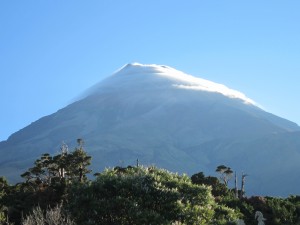
Clould enshrouded Mt. Taranaki looming above the jungle
The day starts innocently enough, with a 6:30 wake-up call and a leisurely breakfast, after which we begin a steady but relatively gentle climb from our hut up through jungle abundant with ferns and giant yucca-like cabbage trees that tower over our heads. After about an hour or tramping and 1000’ of ascent, the jungle gives way to knee-high shrubs that remind us of mesquite. As we continue the climb and our heads now rise above the flora, the view over the jungle below becomes expansive, though we also notice clouds beginning to roll in from the Tasmin Sea to the west.
We reach the “Puffer”, a paved section of the trail that heads straight up the next 1000’ of vertical over less than a mile, a section apparently named after the sound we make while climbing it. A shelter and microwave tower loom ahead, the last structures below the summit, still more than 3000’ above. After a brief rest and refuel at the shelter, the trail enters the Hongi Valley and becomes a series of steep steps heading without diversion or uncertainty directly to the top of the canyon. Those clouds that had been skirting the side of the mountain now fill the canyon, hiding each of us from the other and from the steep climb ahead and the similarly steep plunge to the side of the stairs.
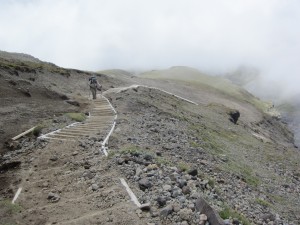
Allie ascending the canyon steps through the clouds
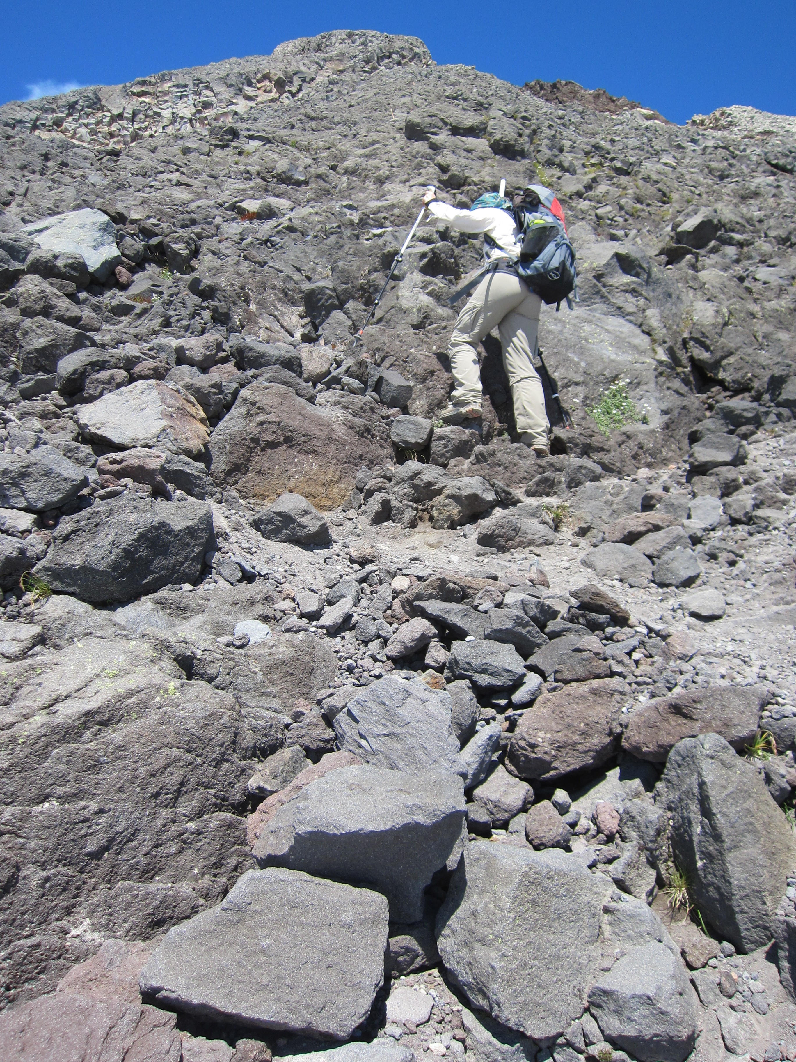
Above the canyon, the official trail ends, leaving us to follow a series of orange poles that mark the route to the summit, still 2000’ above. Stairs give way to scree, reminding us of our love/hate relationship with these golf ball sized pieces of pumice. Scree is great to walk down, as one step leads to a long and (usually) gentle slide of a few feet down the hill, a method I like to call “screeing”, as it feels a bit like skiing on 14” long skis. Uphill is a different matter altogether, as one step up leads to the same 2-3’ slide back down the hill. We spend the next 45 minutes cursing the hill, slipping and sliding backwards as much as moving forward, trying to gain a mere 500’ of elevation by climbing 1500’. I settle into a “sprint then rest” method, where I sight the next solid uphill rock, and sprint as fast as I can to the reach it before my forward momentum slows and the scree invariably pulls me back down the hill. On occasion, I miss my target rock and wind up sliding back down to my origin, cursing the slope and the scree as I return to where I began.
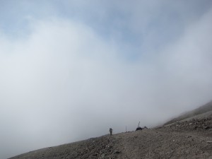
Allie ascending the scree field leading to the Lizard
While we are having a rough go on the scree, we come across an unlikely vision on the scree slopes: three unicyclists coming down the mountain! We ask them if this is a new entry for the Guinness book or records, and one replies, “Oh, it might have been when we did it the first time a few years ago”! Turns out it was his third time to the top of Mt. Taranaki with his unicycle. These guys wore lots of padding, and they were all Kiwis.
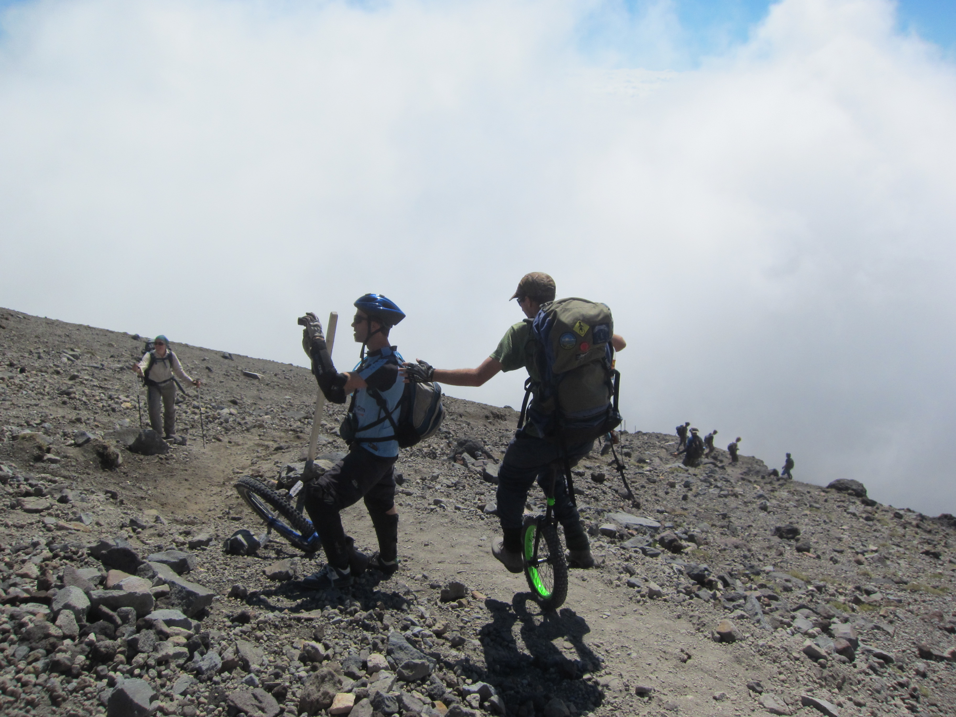
Unicyclists - yes unicyclists! - coming down Mt. Taranaki
At last, we reach the “Lizard”, a spine of hard rocky lava that flowed out of the crater from the summit. For the first time, we can see where the trail enters the crater. Way, way, above. Yikes! This is by far the steepest part of the climb, as the sloping cone of the mountain reaches its apex, and frequently requires 4- and 5-point climbing – two hands, two feet, and one butt. Our hiking poles are of limited value here, so we settle into a combination of scampering, walking, clambering, and deep-knee-bending thrusts as we scramble our way up the final 1000’ up to the crater. It’s slow work, and not a place you’d want to slip, as while the lava cooled many years ago, it remains razor sharp in places. Hawaiians have a word for this kind of lava – a’a (ah-ah)– and I find myself making a similar noise when I touch it the wrong way.
Straight up the Lizard we go!
At last we see the crater beneath us! Getting into the crater proves a bit tricky, as the trail narrows to a couple of feet wide, a narrow path effectively carved out of a the face of a lava cliff, with an imposing wall of a’a scraping us on our left , bumping us toward a 100’ drop on our right. We safely navigate this section, making it to the floor of the crater to find a wondrous world of snow, ice, and rapidly flowing melt water as it plunges into the unseen depths of the crater.
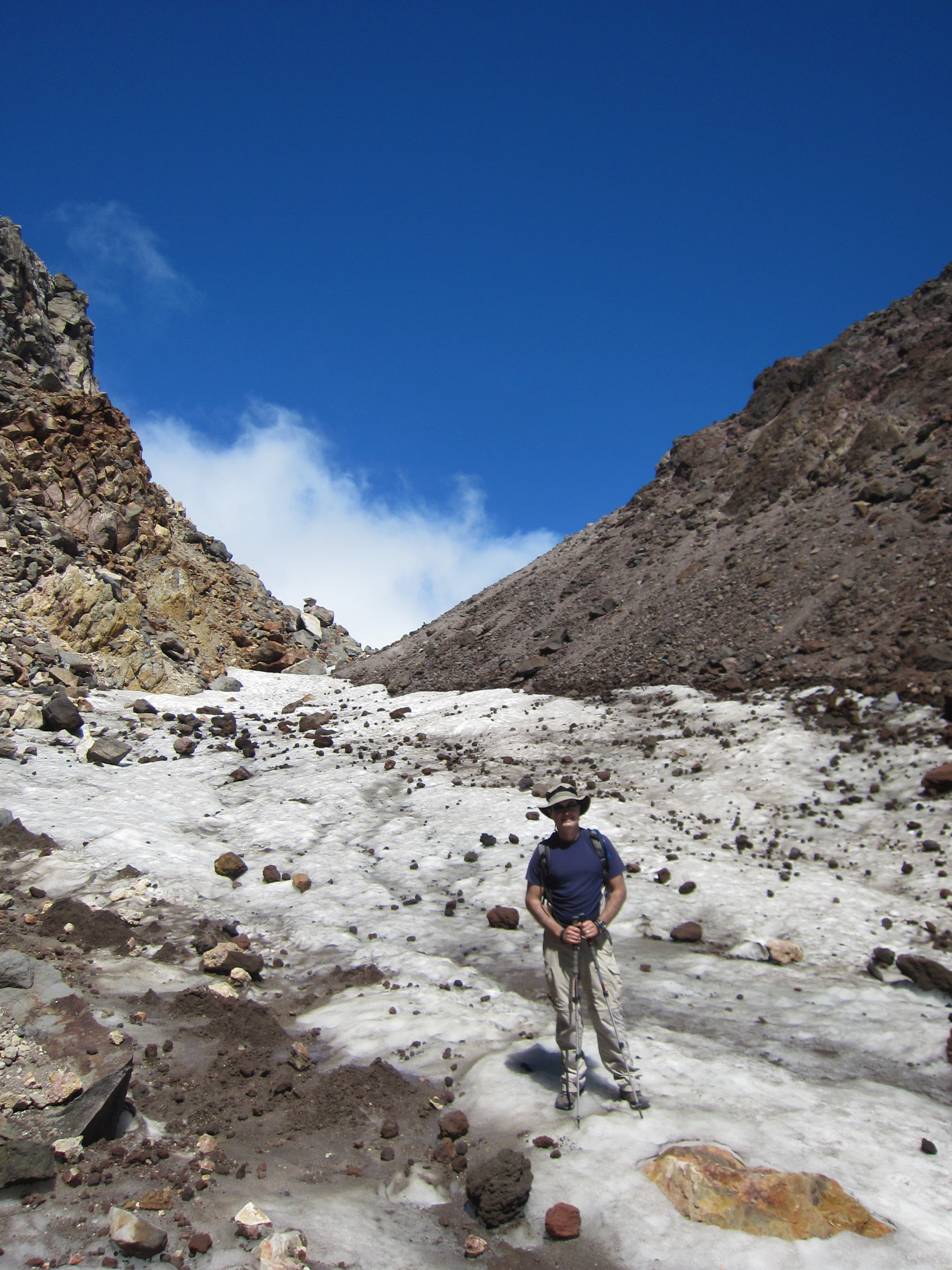
In the snow-filled crater just beneath the summit
The true summit now lies to our right, a few hundred vertical feet of scrambling on volcanic scree and a’a to reach the summit plaque officially marking our goal. Twenty minutes after setting off from the crater, we find there is no more up to climb, and views open expansively in 360 degrees. A solid layer of clouds thousands of feet below stretch to the horizon in many directions, but welcome breaks allow us views of the jungles and of the Tasmin Sea to the west and the Pacific Ocean to the east, more than a vertical mile and a half below. We literally can see clear across the county. To the north, Mt. Ruapehu and Mt. Ngauruhoe (better known as “Mt. Doom”) peek out above the clouds, beckoning us to come climb them another day. Surprisingly, countless ladybugs flutter around us in this barren Antarctic environment.
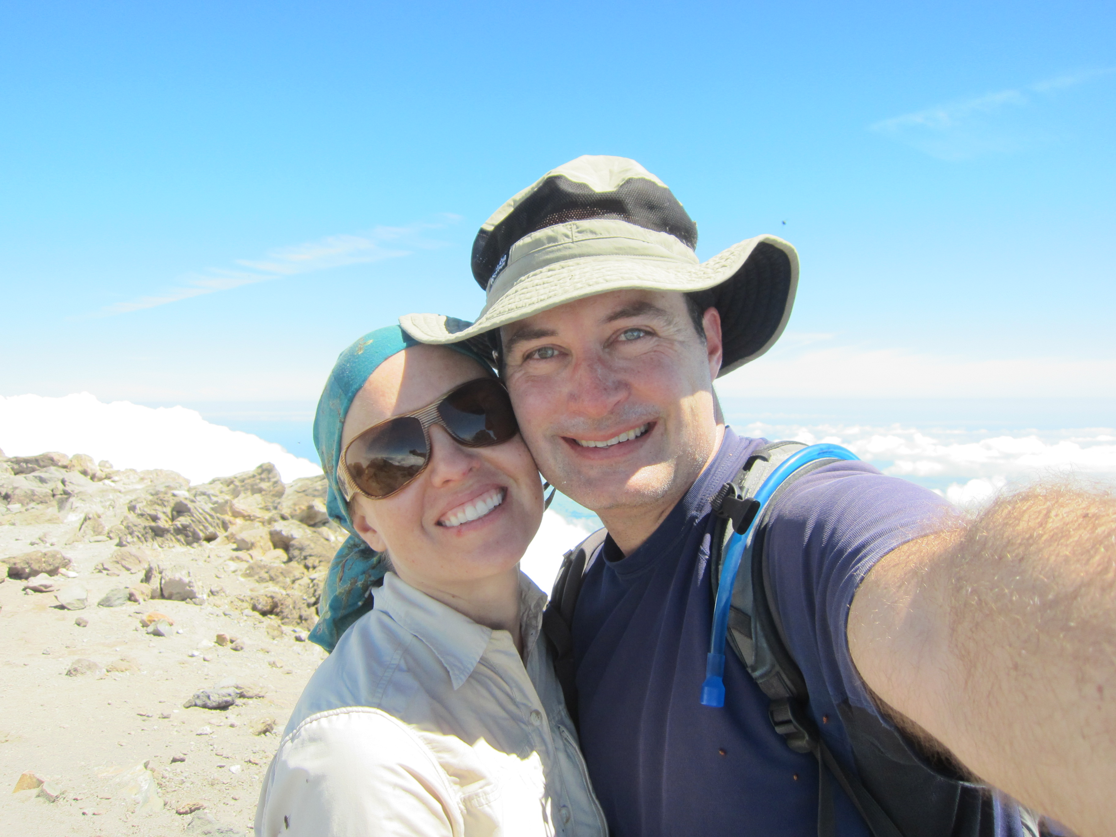
At the summit!
After enjoying the view of the summit, it is time to begin the long trek back to the camp house. While gravity is now on our side, we soon discover that the way down is no less treacherous than the climb. Allie’s love-hate relationship with scree quickly becomes a hate-hate relationship, as the unstable rock leads to more than a dozen wipeouts, landing her atop a sharp rock more than once, transforming her lower half into a red, blue and purple connect-the-dots Escher.
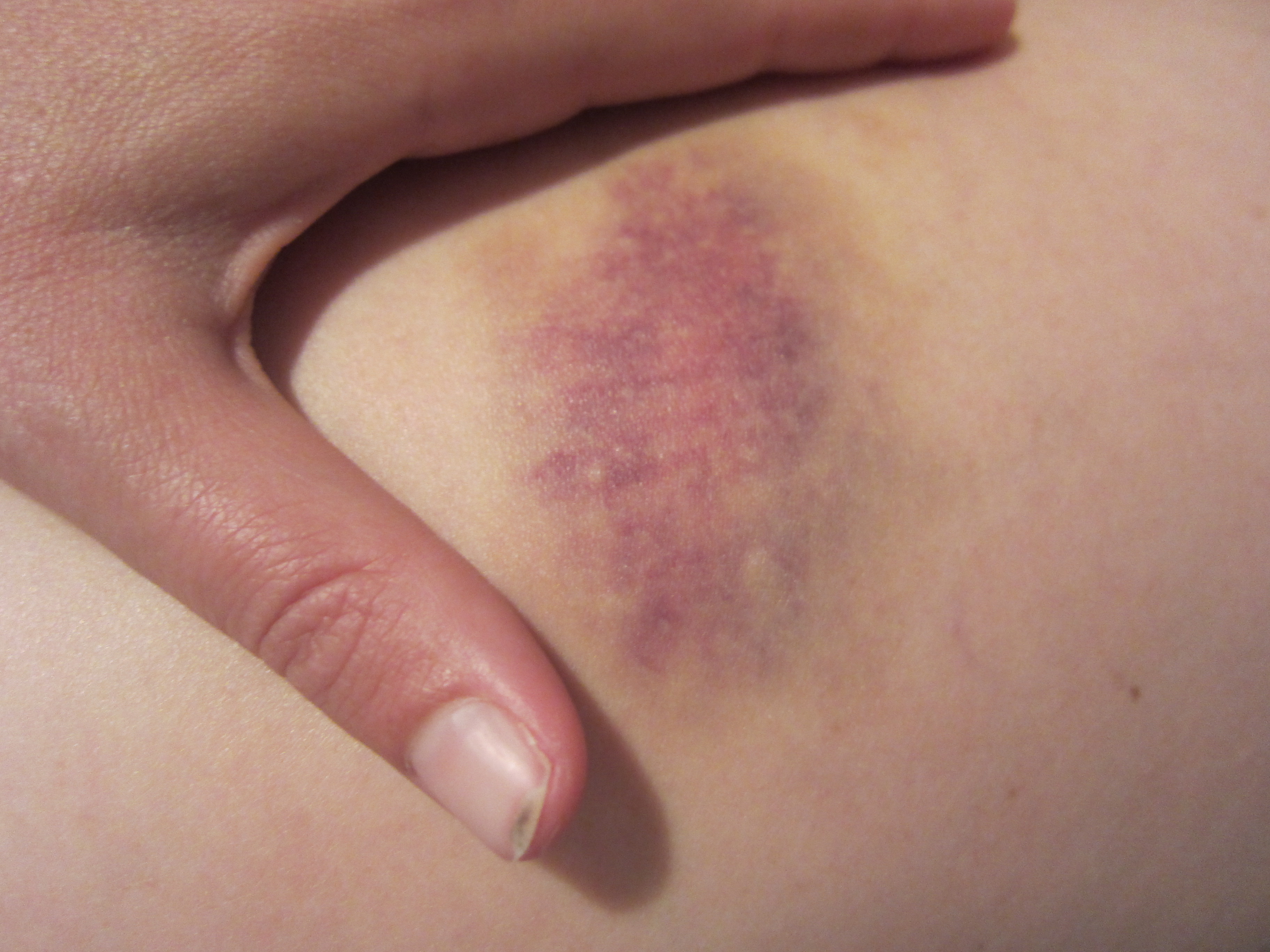
One of Allie's bruises
Ten hours after we take our first steps toward the summit, the front door of our camphouse opens and we spill in for a long shower, dinner, and much needed sleep. In less than 48 hours we begin our Alpine trek through the mountains of Tongariro!
See more photos from our time in Taranaki and our climb up the mountain.
{ 2 comments… read them below or add one }
Ow! Ow! a’a a’a
a’aa’a indeed! It’s a week later and I still have a patch of eggplant-colored skin.